Severe Storms Persist in the Southern Plains, Gulf Coast

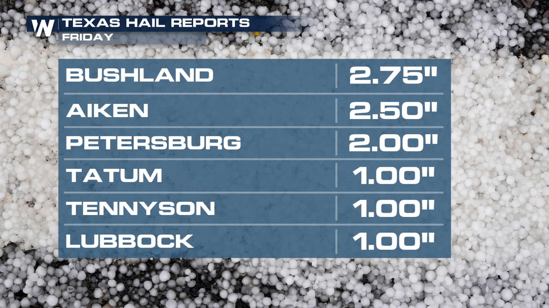
Several rounds of storms have been swinging through the Southern Plains the last few days, producing large hail, damaging winds, flooding, and even a few tornadoes. Severe storms will remain in the forecast for the long weekend, with all modes of severe weather possible. Yet again, hail was the biggest risk of severe weather on Friday, with hail up to tennis and baseball-sized across the Texas Panhandle.
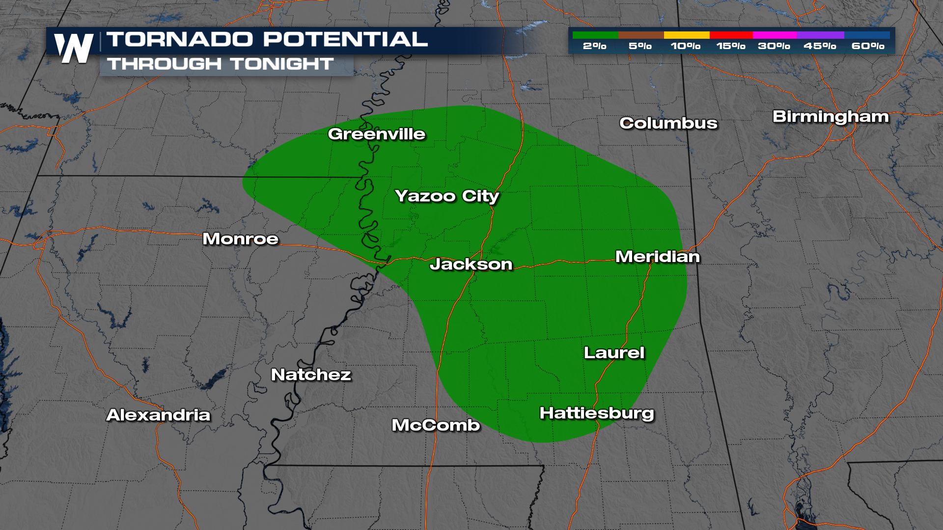
Additional scattered thunderstorms are in the forecast for parts of the Lone Star state and Mississippi (top of page), with the biggest hazards being damaging winds, large hail, and heavy downpours. An isolated tornado or two will be possible across portions of the Magnolia State.
 Forecast
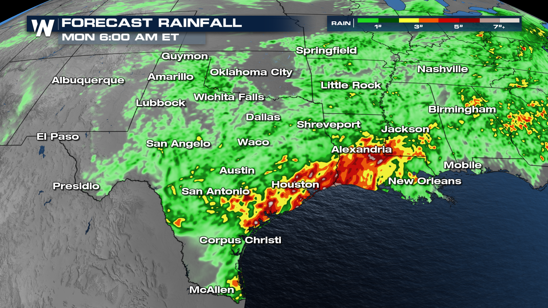
New rounds of thunderstorms are expected across the Southern Plains through the evening hours, with some storms persisting overnight. By Sunday, the upper-level energy supporting the storms will move farther east toward the Sabine River, bringing a better chance for storms into Louisiana and Mississippi.
As mentioned above, heavy rainfall is likely in spots, and flooding will occur. The Gulf coast of Texas and Louisiana could see rainfall of over six inches!